- Accede I
- Regístrate I
- carrito
Brañas de Sar
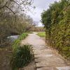
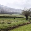
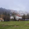
Las Brañas de Sar son un espacio de unas 33 hectáreas que forman parte de la cuenca del río Sar. El paseo discurre desde las piscinas y el Multiusos Fontes do Sar hasta Pontepedriña, enmarcado al oriente por los montes Viso, Gaiás y Santas Mariñas y al poniente por la fachada urbana de la ciudad, con la vía del ferrocarril.
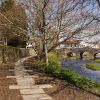
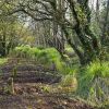
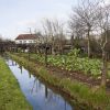
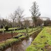
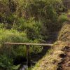
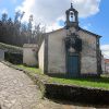
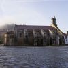
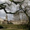
A lo largo de 4 kilómetros, entre la ciudad y los montes, el paseo se sumerge en una Santiago rural de sembradíos, terrazas en las laderas, molinos, acequias y el bosque de ribera, pasando por la bellísima Colegiata de Sar, la calzada o Camino Real y el puente románico hasta llegar al parque Eugenio Granell.
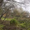
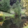
Las "brañas" en Galicia son zonas parcialmente anegadas, situadas a las orillas de un río, que están verdes todo el año y en las que antiguamente pacía el ganado de las pequeñas explotaciones agrarias gallegas. Se trata de un ecosistema frágil y con una función muy importante en la regulación del agua porque la retienen cuando llueve mucho y evitan que vaya de golpe a los ríos produciendo inundaciones.
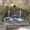
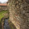
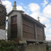
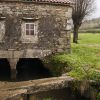
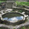
Hasta los años 60 del pasado siglo, estas brañas eran un espacio poblado. El Sar era la playa de Compostela. Grandes y pequeños iban a bañarse en sus pisicinas naturales y a merendar en sus orillas. Otros lavaban, trabajaban las tierras o iban a moler maíz en los molinos. En el conjunto etnográfico queda testimonio en cinco molinos y un sistema de canales, acequias, muros, lavaderos y represas que conducen el agua, además de los caminos, pasos y puentes de piedra.
Algunos de los monumentos y puntos de interés que se ven en el recorrido son:
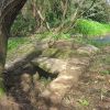
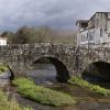
- El puente románico de Sar, de 22 metros de largo, parte de la calzada romana de Sar y ruta de entrada de los peregrinos de la Vía de la Plata a Santiago. Está vía penetraba en la ciudad amurallada por la puerta de Mazarelos o por la puerta de la Mámoa.
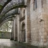
- La Colegiata de Sar.
- La capilla dedicada a San Blas en la entrada de la Colegiata.
- Capilla de Santas Mariñas, en el monte del mismo nombre, de una sola nave y portada con espadaña. Solo se abre el 18 de julio para la romería.
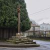
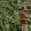
- Cruceiro de Sar: Situado en el cruce de los caminos que van a Aríns y a Angrois, mide unos 4 metros sumando la base y muestra las tallas de la Virgen y de Cristo.
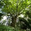
En cuanto a la vegetación, abundan los pastos naturales y las huertas de legumbres, hortalizas y árboles frutales. En las zonas de ladera de monte se encuentran las tierras de labradío (agras). En torno al río y a los canales se localizan zonas de bosque de ribera con abedules, alisos, sauces, saúcos, fresnos, laureles, robles, lirios y numerosas herbáceas.
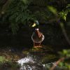
Las Brañas de Sar proporcionan refugio y alimento para varias especies de reptiles, anfibios, aves y mamíferos. Pueden encontrarse nutrias, erizos, topos, musarañas, liebres, ardillas, lirones, ginetas, armiños, zorros, murciélagos, ánades reales, garzas, escánceres, cobras de collar y de agua, víboras, lagartos, tritones, salamandras, sapos, ranas y numerosas aves, como águilas, halcones, gavilanes y lechuzas.
+INFO: Parques fluviales de Santiago
FICHA TÉCNICA
Distancia total: 4418 m
Elevación máxima: 286 m
Elevación mínima: 251 m
Total ascendido: 452 m
Total descendido: -473 m
Tiempo total: 00:42:54
Autobús: Un total de siete líneas de autobús urbano permiten acercarnos a las Brañas de Sar, bien sea desde Pontepedriña, el Puente de Sar o Fontiñas, la Avenida de Lugo y el Multiusos de Sar. Se pueden utilizar las siguientes líneas:
Línea 7: Calle de Valle Inclán/Aríns
Línea 9: Casas Novas/Viso/Multiusos/Ciudad de la Cultura
Línea 12: Los Tilos/Hospitales
Línea C2: Estación de autobuses/Fontiñas/Hospitales/Vite/Estación de autobuses
Línea C4: Estación de autobuses/Vite/Hospitales/Fontiñas/Estación de autobuses
Línea C11: Circular de Fontiñas
Línea P3: Calle de Valle Inclán/Santa Lucía/A Pajuela
Aparcamiento: Por la zona norte se puede aparcar en el Multiusos de Sar y para iniciar la visita por el sur se puede usar el parking libre de Pontepedriña.


