- Accede I
- Regístrate I
- carrito
Sendero del Deza
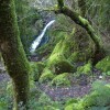
El Sendero del Deza es un recorrido de tipo lineal, de ida y vuelta por el mismo trazado que une tres lugares emblemáticos de la Comarca de Deza: la Fervenza do Toxa, la Playa Fluvial de A Carixa y el Monasterio de Carboeiro.
Distancia: 6 km
Tiempo: 2 horas
Dificultad: baja
Punto de inicio y fin: Fervenza do Toxa / Monasterio de Carboeiro
Circular: no
Características:
El Sendero del Deza tiene la consideración de Pequeño Recorrido (PRG-18) y cuenta con una señalización para indicar el camino correcto. Puede comenzarse en cualquiera de los puntos pues en todos ellos hay espacio para dejar aparcados los vehículos.
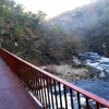
Tiene una longitud de unos 6 Km. Comenzando en la Fervenza do Toxa, y tras contemplar desde los miradores este espectáculo natural, de más de 70 metros de salto, descendemos hacia el pie de la misma para acompañar al río Toxa en sus últimos metros hasta que desemboca en el Deza. Se cruza este río por un puente de hierro para llegar a la ermita de San Paio y posteriormente a la localidad de Merza. Se continúa hasta la playa fluvial de A Carixa, y después de una subida de cierta dificultad, nos desviamos a la derecha por el lugar de A Portela (aunque podría acortarse el recorrido si continuamos carretera arriba hacia el balneario Baños da Brea para enlazar por el antiguo camino que llevaba a Carboeiro).
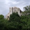
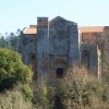
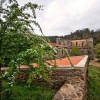
Una vez llegados al lugar de A Portela, seguimos el camino paralelo al río, según la señalización marcada, hasta encontrar la calzada medieval que cruza el antiguo puente medieval, reconstruido varias veces, también llamado Ponte do Demo, y que definitivamente nos conducirá al cenobio benedictino de San Lourenzo de Carboeiro, fundado en el siglo X, considerado como la mejor muestra gallega de estilo románico de transición, también denominado románico ojival.
La ruta también puede iniciarse en el Monasterio de Carboeiro, con la ventaja de tener los vehículos más controlados.
Cómo llegar
Se accede al comienzo de la ruta desde la villa de A Bandeira, situada en la carretera N-525, que une Ourense con Santiago de Compostela. Luego, desde A Bandeira, hay que dirigirse a la parroquia de Pazos por la carretera PO-204 que va a Merza y Vila de Cruces.
+info: www.turismosilleda.es


