


- Accede I
- Regístrate I
- carrito
Camino Francés
La ruta por excelencia presenta dos variantes, dependiendo del punto por el que entren los peregrinos desde Francia:
Camino Francés propiamente dicho: Llegados a Saint Jean Pied de Port (Francia), los peregrinos recorren en España 774 kilómetros atravesando las provincias de Navarra, La Rioja, Burgos, Palencia, León, Lugo y A Coruña. Para una media de 20-25 kilómetros diarios, suelen emplearse unos 30 días en llegar a destino.
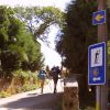
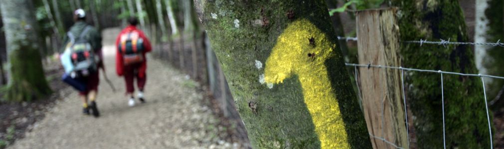
La ruta comenzó a ser señalizada con flechas amarillas en los años 80, gracias al esfuerzo del párroco de O Cebreiro, Elías Valiña, y de la Asociación de Amigos del Camino de Navarra. A ese primer símbolo se superponen ahora los mojones kilométricos y las señales institucionales de las distintas regiones.
Roncesvalles – Pamplona – Puente La Reina – Estella – Logroño – Nájera – Santo Domingo de la Calzada – Burgos – Castrogeriz - Carrión de los Condes – Frómista – Sahagún – León – Astorga – Ponferrada y entran a territorio gallego por O Cebreiro – Samos – Sarria – Portomarín – Palas de Reis – Melide – Arzúa – Santiago de Compostela.
La otra variante entra desde Francia por Somport, territorio aragonés, y continúa por las provincias de Huesca, Zaragoza y Navarra hasta arribar – tras 6 días y 167 kilómetros - a Puente La Reina, donde se une al Camino Francés.
Somport – Canfranc - Jaca – Sangüesa – Lumbier - Puente La Reina.
Galería de imágenes

Camino Francés
Otras entradas